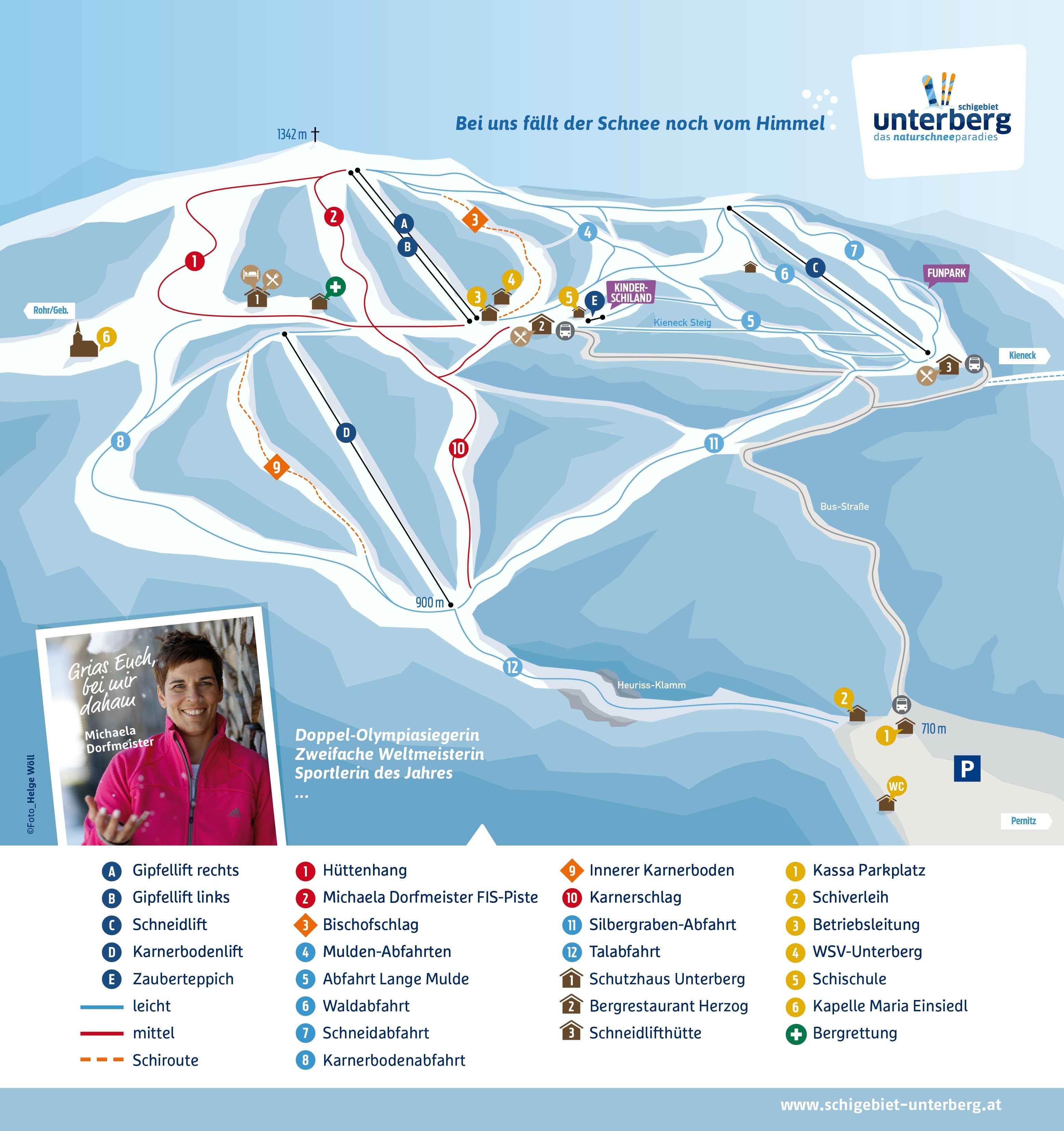
Unterberg - Pernitz Piste Map
View the trails and lifts at Unterberg - Pernitz with our interactive piste map of the ski resort. Plan out your day before heading to Unterberg - Pernitz or navigate the mountain while you're at the resort with the latest Unterberg - Pernitz piste maps. Click on the image below to see Unterberg - Pernitz Piste Map in a high quality.