When the winter snow finally retreats from the high-altitude playgrounds of the West, it uncovers wildflower-lined valleys and stunning hiking trails, some of which are on the same slopes of volcanoes, like Mt. Hood, that many skiers and riders ripped down during the winter. In the summer, these peaks reveal an otherworldly landscape and some of the most dramatic vistas in North America. Explore out list of some of the best volcano hikes in the U.S.
The Best Volcano Hikes in the U.S.
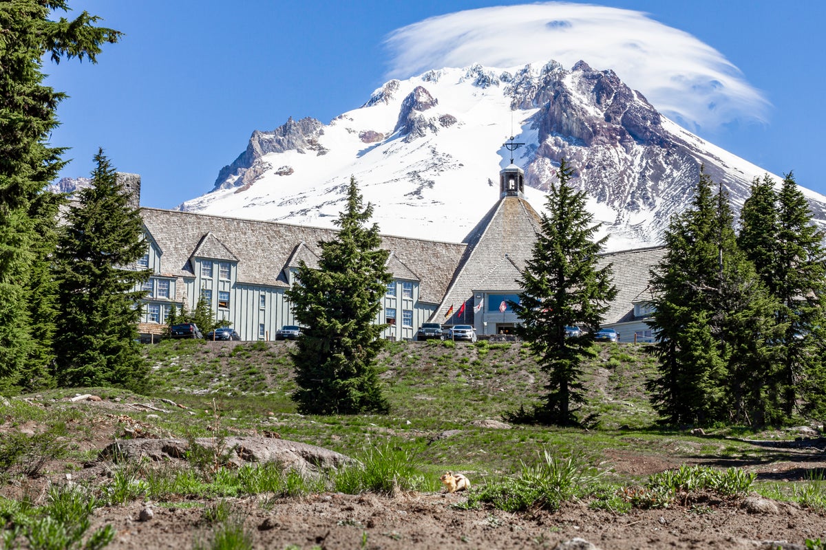
Mt. Hood, Oregon
Mt. Hood is Oregon’s highest peak, and its extensive trail network allows for volcano hiking accessible to any skill level. For day hikers looking to get near the top of the dormant volcano, the Paradise Park Loop offers a rewarding high‑elevation hiking experience without any technical climbing required. Depending on where you begin, the route ranges from 9.7 to 13.9 miles and features 2,400 to 3,000 feet of elevation gain as it meanders through dense forests and broad alpine meadows. Due to this trail’s high elevation, weather can change rapidly, so pack plenty of layers. Furthermore, check the forecast ahead of time to ensure you won’t be caught off guard by storms. First-timers may want to go with a guide or a local who’s hiked it before.
For those who actually want to climb to the top of Mt. Hood, there are guided two-day trips offered by Timberline Mountain Guides during late spring and early summer. The experiences includes a half-day of training, so prior technical climbing experience isn’t required. Find out more information on their website.
There are plenty of more casual hikes around Timberline Lodge, which is located at 6,000 feet on Mt. Hood. One of the most direct and short hikes is up to Silcox Hut, located at 7,000 feet, near the top of the Magic Mile ski lift. The hike is just about two miles round-trip. For a truly uniquely experience, take a picnic with you to enjoy at the top of the hike near the hut, as you take in the views of Mt. Hood and the surrounding rolling hills, valleys, and lakes. Then hop on the Magic Mile lift to ride back down to the lodge. Note: The Magic Mile Sky Ride runs from early July through Labor Day, weather permitting. Tickets are required.
Newberry National Volcanic Monument, Oregon
South of Mt. Hood, closer to Bend, Newberry National Volcanic Monument’s Big Obsidian Flow Trail stands out as one of Oregon’s most accessible volcano hikes, delivering dramatic scenery on a short loop. This one‑mile trail climbs onto Oregon’s youngest lava flow—an immense field of black volcanic glass and pumice formed about 1,300 years ago. The route offers close‑up views of jagged obsidian formations, sweeping perspectives over Paulina Lake, and a rare chance to walk directly on the visually-striking geologic feature. With just 200 feet of elevation gain, this route is approachable for most hikers while still feeling otherworldly and adventurous. While it’s not quite the tall volcano like many of the other destinations on this list, it provides one of the most unique and memorable hikes in Oregon.
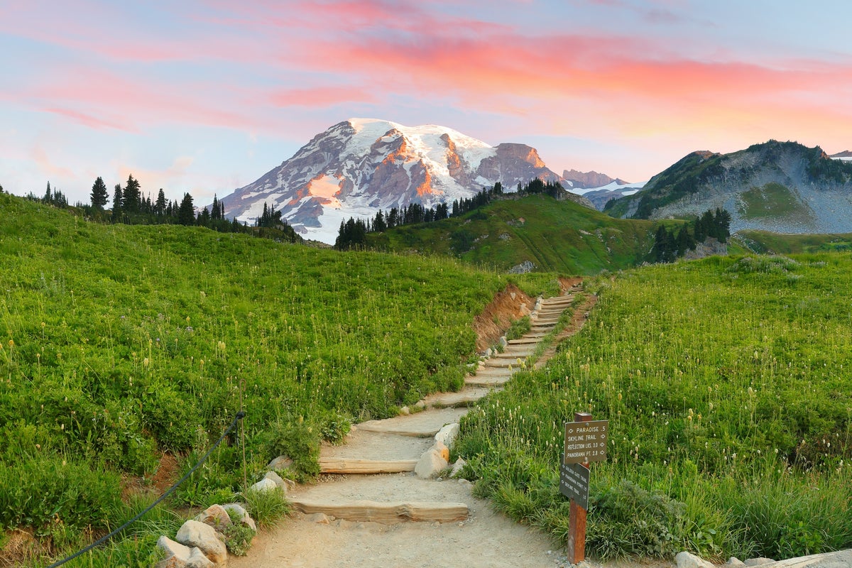
Mt. Rainier, Washington
Climbing Mt. Rainier is neither for the inexperienced nor for the faint of heart. Summiting Mt. Rainier, which is next to Washington’s largest ski resort, Crystal Mountain, is a demanding alpine climb that requires glacier travel skills, technical gear, and strong conditioning. The standard Disappointment Cleaver route covers roughly 14–15 miles round‑trip with about 9,000 feet of elevation gain, usually completed over two to three days. Climbers navigate crevassed glaciers, steep snowfields, and exposed ridgelines, often while enduring rapidly changing weather and natural hazards. Because of these challenges, teams must be proficient with crampons, ice axes, rope systems, and crevasse‑rescue techniques, and they must secure the required climbing permits before attempting the summit. Going with a guide is strongly recommended.
For those looking for a less technical way to experience Mt. Rainier, there are a number of much easier day hikes, all of which feature stunning views. For close-up views of the glacier and wildflower-strewn meadows, look no further than the moderate-to-strenuous Skyline Trail, which is 5.5 miles round trip with an elevation gain of 1,700 feet. Alternatively, the Naches Peak Loop offers a gentler journey while still providing stunning views of Mt. Rainier and alpine lakes. This trail is 3.5 miles round trip and gains 500 feet of elevation. Even in late spring and summer make sure to do your research and be aware of snow and other conditions and hazards that you may encounter. AllTrails is a good starting place so that you can see comments from recent people who have hiked these trails.
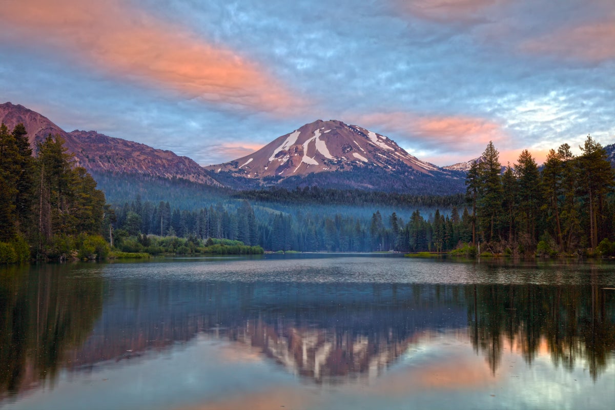
Lassen Volcanic National Park, California
The Cinder Cone Trail in Lassen Volcanic National Park is one of the park’s most striking volcano hiking experiences, leading hikers up loose cinder to the rim of an extinct volcano. For the full experience, hike to the summit, which is a strenuous 4-mile round-trip that gains 6,907 feet of elevation. The summit trail begins near Butte Lake before winding through a quiet pine forest and past dramatic lava beds. The final ascent is the trail’s signature challenge: A short but intense slog up a steep, sandy cinder slope where each step slides back slightly, making the climb feel tougher than the stats suggest. At the summit, hikers can walk the rim, peer into the crater, and take in sweeping views of the Painted Dunes and the surrounding lava flows—some of the most colorful and photogenic volcanic features in the park. Make sure to maintain ample room (at least 15 feet) from the edge of the crater to avoid injury.
During early summer, advanced skiers will also enjoy hiking up to the top and skiing back down. Note that hazards like rocks and thin cover exist.
Mt. Shasta, California
Similar to Mt. Hood and Mt. Rainier, summiting Mt. Shasta is a demanding alpine climb. Avalanche Gulch, the standard route, is 11 miles round trip and gains 7,100 feet in elevation. While it’s possible to summit in one day, the ascent is often split into two days, separated by a night of camping at Lake Helen. Due to hazards like rockfall, strong winds, and avalanche danger, this route is only suitable for advanced hikers. Hiring a guide is strongly recommended.

The good news is, less experienced hikers can also get the Mt. Shasta hiking experience, even without technical knowledge. The McCloud River Trail is four miles round trip, with an elevation gain of 3,600 feet, that passes three beautiful waterfalls. Between waterfalls hikers will be treated to views of multiple layers of basalt lava rock and mud flows, providing a glimpse into the volcano’s history.
A few miles away, the Panther Meadow trail offers an even gentler way to explore Mt. Shasta’s upper slopes. This 1.4-mile route boasts only 350 feet of elevation gain, but offers views of meadows, springs, and Mt. Shasta’s southern face. Because the area sits at nearly 7,500 feet, hikers still get the feeling of being close to the volcano’s summit without venturing onto steep snow or technical terrain.
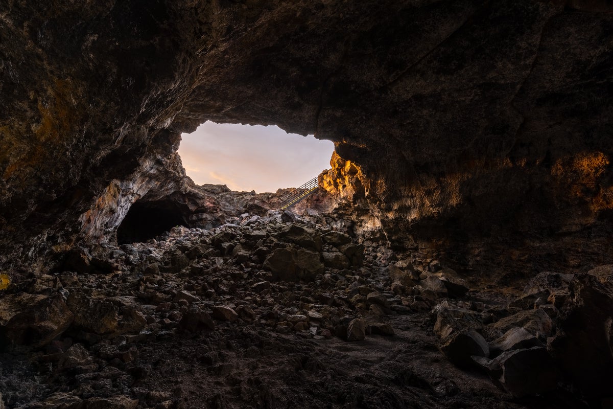
Craters Of The Moon National Monument, Idaho
Hiking the Tree Molds Trail at Craters of the Moon offers one of the monument’s most unusual windows into volcanic history: The preserved shapes of ancient trees burned and buried by lava. This 2‑mile round‑trip trail crosses open lava fields and patches of sagebrush, gaining 108 feet of elevation before reaching the tree molds themselves—hollowed impressions and vertical casts left when molten basalt flowed around standing forests and cooled in place. The landscape is stark and exposed, with uneven lava surfaces and little shade, so sturdy footwear, sun protection, and plenty of water is essential. The trail’s gentle grade makes it accessible to most hikers, but the terrain’s rough texture and heat can make it feel more strenuous than the mileage suggests.
Haleakala National Park, Hawaii
Hiking the Keonehe’ehe‘e (Sliding Sands) Trail in Haleakalā National Park is one of Maui’s most surreal and memorable volcanic experiences. Beginning near the 10,000‑foot summit of Haleakalā, the trail descends into the vast crater, revealing shifting colors of cinder, ash, and lava rock that create a landscape often compared to Mars. The route can be tailored to different abilities, but the full trek is approximately 18 miles with 4,140 feet of elevation gain. Key landmarks along the route include the 3.9-mile descent to the crater floor, the vibrant minerals of Pele’s Paint Pot tucked against the Halāli’i cinder cone, and the famous Kawilinau (Bottomless Pit) located roughly 5.7 miles from the trailhead.

Mauna Kea, Hawaii
Hiking the Mauna Kea Summit Trail is one of Hawaii’s most demanding and dramatic volcanic hikes, combining high‑altitude exposure, barren lava landscapes, and sweeping views above the clouds. The route begins at the national landmark’s visitor center, which sits at an elevation of roughly 9,200 feet, and leads to the 13,803‑foot summit, covering 13 miles round‑trip with 4,900 feet of elevation gain. The trail begins on coarse cinder and ash slopes dotted with hardy alpine plants before transitioning into long, steep stretches of loose volcanic rock and switchbacks that grow more strenuous as the air thins. Near the top, hikers pass cinder cones and approach the cluster of astronomical observatories that mark the summit plateau. The combination of altitude, cold temperatures, strong winds, and intense sun makes this a serious undertaking, and many hikers experience the effects of thin air even with good conditioning. Carrying ample water, warm layers, sun protection, and plenty of food is essential, and hikers must be prepared for rapidly changing weather, limited shade throughout the ascent, and decreased oxygen.
Those looking for an easier route should try the Lake Waiau trail, which leads to a high-elevation alpine lake. The 1.4-mile trail has 269 feet of elevation gain and leads to Hawaii’s only alpine lake, which is set among cinder cones and volcanic terrain.
Tips Before Hiking
Please plan accordingly before beginning your trip to one of these volcano hikes in the U.S. Some of these hikes are quite long, strenuous, and technical, and therefore not recommended for inexperienced hikers. Many of them are on national park land, so national park websites and ranger stations will be a good starting place as you’re planning a trip. Be sure to do some careful planning and research of hazards, wildlife, current conditions, and weather. For some of these hikes, you can find experienced local hiking guides or guiding companies that you can go with. Finally, remember to pack plenty of water, especially during the hot summer months, since a lot of these hikes are exposed and have big elevation gains.
Header image ©Timberline