There is a rare air found only above 14,000 feet. For many hikers, bagging a 14er is the ultimate milestone—a rugged test of grit and endurance that’s rewarded with unparalleled views and bragging rights that’ll last a lifetime. But for the uninitiated, picking that first 14er to summit can feel daunting, especially if you aren’t looking for technical mountaineering. So we’re here to help you choose the right peak to hike above the clouds.
First things first, the 14er season, especially in the lower 48, typically begins in late June or early July once the snowpack recedes. If you’re traveling from lower elevations, build in at least a full day to acclimate before your hike. That extra time helps your body adjust and reduces the risk of altitude illness, which can affect even experienced hikers who ascend too quickly. Spend the day resting, drinking plenty of water, eating nourishing and iron‑rich foods, and avoiding excess alcohol and caffeine. As your hike approaches, keep an eye on weather forecasts—conditions and weather can shift quickly at high elevations.
On the morning of your hike, pack at least three liters of water per person, carb‑rich snacks, layers, and a first aid kit. If you’re navigating with your phone, download maps for offline use and bring a portable charger; switching your phone to airplane mode once you start hiking will help conserve battery. Arrive at the trailhead early to maximize daylight and stay alert to changing skies, especially during summer thunderstorm season.
Now, without further ado, let’s get to our list of some of the best 14ers to hike in the U.S.
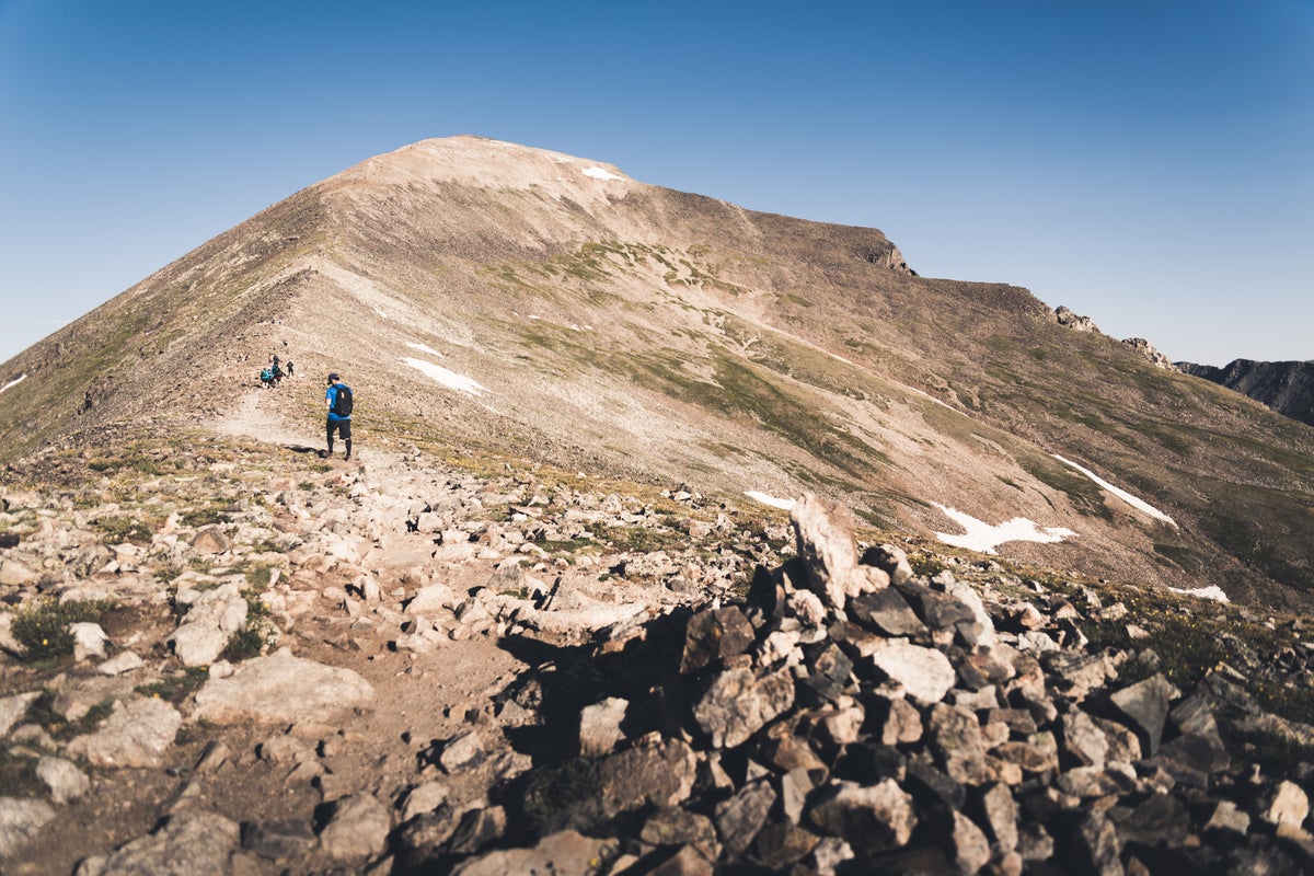
Quandary Peak, Colorado
Quandary Peak, located about 85 miles from Denver, is one of Colorado’s most popular and accessible 14ers. The well-defined, easy-to-follow trail winds through big alpine views with a steady pitch, and gains roughly 3,450 feet of elevation over the 6.75-mile round-trip trek. Despite Quandary Peak’s reputation as a more approachable 14er, this is still a challenging route. Anyone who hikes it should be able to complete longer hikes on sustained pitches and at higher elevations. Depending on ability levels, hiking Quandary Peak typically takes between five to seven hours to complete. Like most 14ers in Colorado, it’s recommended to start hiking Quandary Peak as early as possible to beat the crowds and heat, and to finish before afternoon thunderstorms roll in.
Grays Peak, Colorado
Grays Peak is another of Colorado’s most approachable 14ers, offering manageable challenges suitable for those hikers who can comfortably complete full-day hikes with significant elevation gains. The standard route, which is 8 miles and has 3,040 feet of elevation gain, begins at Stevens Gulch. Keep your eye out for mountain goats as you make your way to the summit. Sudden weather shifts, like high winds and afternoon thunderstorms, are common at Grays Peak during the summer. Therefore, pack plenty of easily removable layers and a waterproof jacket. Because it’s only 54 miles from Denver, and a relatively doable day trip, the Grays Peak trail is often crowded, especially on weekends. We recommend arriving as early as possible.
Mt. Bierstadt, Colorado
Mt. Bierstadt sits just 60 miles from Denver, taking about an hour and 40 minutes by car. At roughly 7 miles round trip, it’s considered one of Colorado’s most approachable 14ers, thanks in part to well‑marked trails and relatively gentle grades for its size. The standard West Slopes route gains about 2,700 feet of elevation, offering a steady ascent. While Mt. Bierstadt is known as an approachable and accessible summit, the hike is still demanding, and anyone attempting it should feel comfortable with longer outings at sustained inclines. Most hikers complete the route in three to six hours, depending on fitness and conditions. Be prepared for rapidly changing weather, lingering snow, and strong winds above treeline.
Handies Peak, Colorado
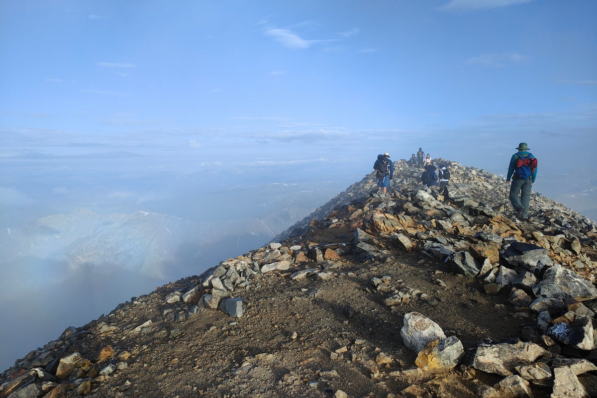
Handies Peak towers in the San Juan Mountains, offering one of Colorado’s most scenic 14er hiking experiences. Most hikers begin the ascent from American Basin, a 5.8-mile round-trip hike, which gains 2,550 feet of elevation to the summit. The trail winds through wildflower‑filled meadows and past Sloan’s Lake before a relatively steady, accessible, rewarding ascent to the summit. Afternoon thunderstorms are common in the San Juans, and snow can linger well into summer, so an early start, warm layers, and sturdy hiking boots with good traction are essential. Important note: A high-clearance, 4WD vehicle is recommended, especially at the last stretch, to reach the trailhead.
Mt. Whitney, California
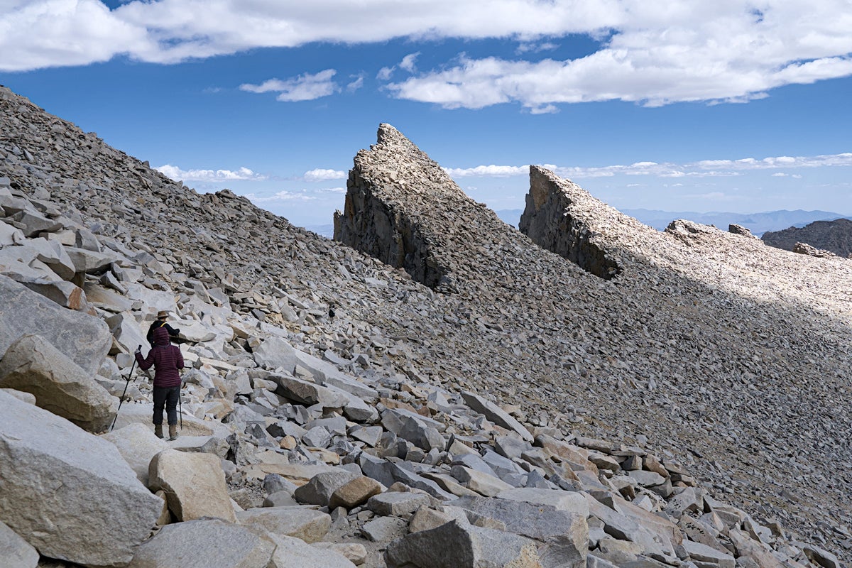
At 14,505 feet in elevation, California’s Mount Whitney is the highest peak in the contiguous United States. The trail offers a non‑technical, but still demanding route to the summit, covering roughly 22 miles round‑trip with 6,600 feet of elevation gain. The combination of distance, altitude, and long exposure above treeline makes this a serious undertaking. Therefore, Mt. Whitney hikers should be comfortable with full‑day hikes on steep, sustained terrain before attempting it. Most people spend 12–16 hours on the trail, starting well before sunrise to avoid afternoon thunderstorms and to ensure enough daylight for the descent. If your group hikes on the slower side, consider planning to conquer this hike in two days. Note that you’ll need to get an overnight permit from the U.S. Forest Service. Camping is only allowed in certain spots along this trail.
White Mountain, California
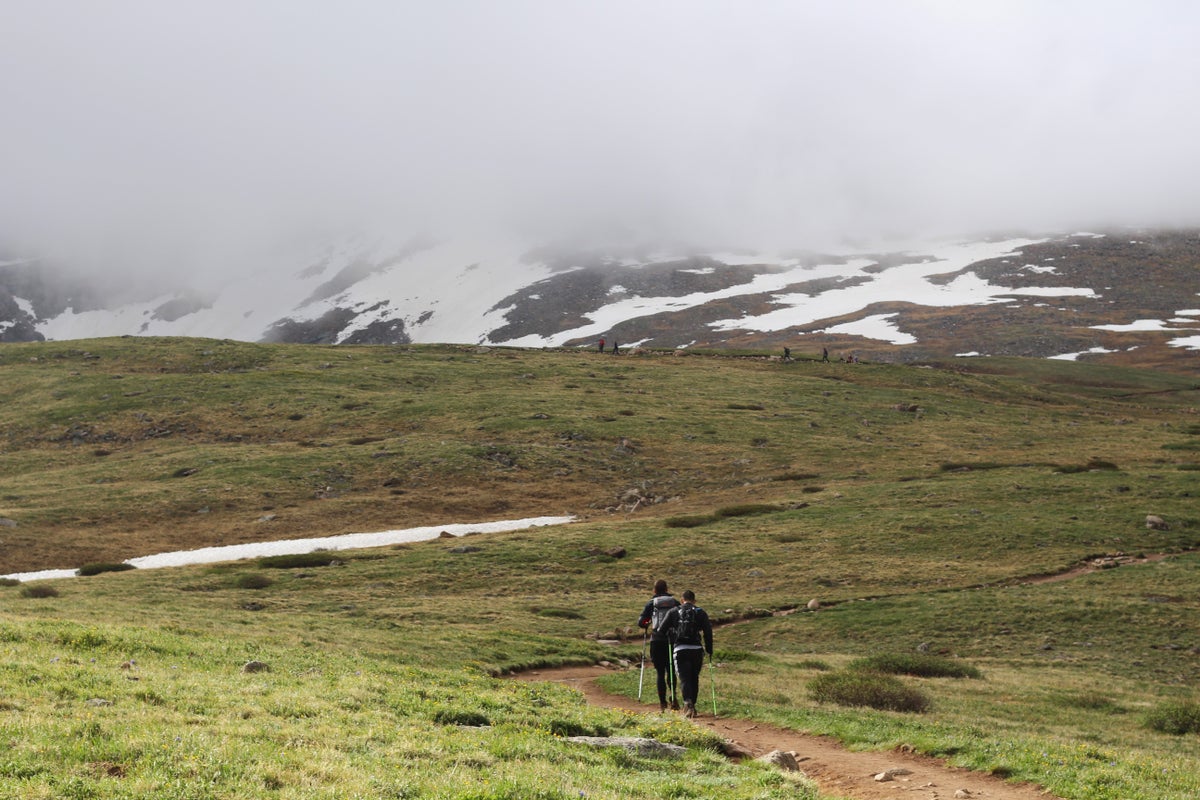
While White Mountain Peak, at an elevation of 14,252 feet, is considered California’s most approachable 14er, it’s still a very demanding hike. The trail, beginning at Barcroft Gate, is 15 miles round trip with around 3,500 feet of elevation gain, making it a very long but steady ascent. The trailhead sits near 12,000 feet, so altitude can feel intense from the very first steps, and acclimatization is essential—consider spending a night or two camping at the Grandview Campground before beginning the journey to decrease the likelihood of altitude illness. The route is fully exposed, with no shade or water sources, and the mountain’s desert environment is known for extreme winds, sudden weather shifts, and very dry air. Hikers should carry ample water, start early to avoid afternoon storms, and be prepared to turn back if altitude illness symptoms or inclement weather develop.
Considering the length of these two California 14ers, hikers may want to try a shorter 14er hike, like the aforementioned Colorado hikes, before attempting these.
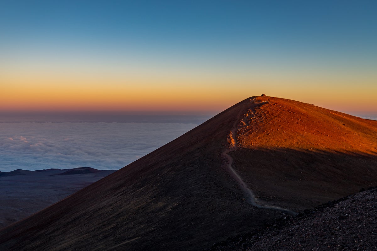
Mauna Kea, Hawaii
Although it’s not technically a 14er, Hawaii’s Mauna Kea comes so close that we’re including it. Rising to 13,803 feet, this massive volcano hike delivers a high‑altitude challenge that surprises many hikers who start their day at sea level. The Humu‘ula Trail begins near the visitor center at about 9,200 feet high and gains 4,500 feet over 13 miles round‑trip. The route is non‑technical but demanding, with steep volcanic slopes, loose cinder, and full exposure to sun, wind, and rapidly changing weather. Because the summit area is extremely dry, cold, and windy—and because altitude sickness is common—visitors are strongly encouraged to acclimate at the Visitor Information Station, hydrate well, and turn back if altitude illness symptoms develop. Rangers also advise that hikers register at the station, avoid ascending if they’ve recently been scuba diving, and be prepared for winter‑like conditions even when the beaches below are warm. Additionally, wearing protective glasses and a face mask is recommended, as loose volcanic ash can irritate the skin, eyes and lungs.