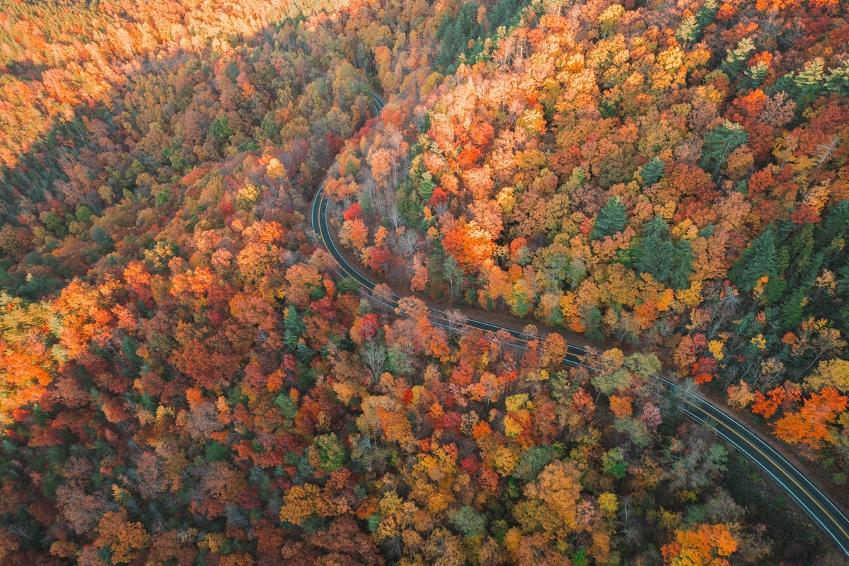
Across the U.S. are nearly 200 national scenic byways. These are more than just roads to get you from one place to another. They are destinations unto themselves, known for their natural beauty, cultural and historical significance, and recreational opportunities. While there are so many incredible scenic byways in the U.S., we’ve picked out what we consider some of the best byways in America.
Before you head out on any of these drives, check road conditions and alerts via Caltrans, the NPS, and local DOT sites. Some of these high-altitude routes—like Montana’s Going-to-the-Sun Road—are seasonal byways that are best visited between late spring and early fall. We’d also recommend downloading a map onto your phone for offline use, or getting a paper map, since some stretches may not have cell service.
Now, let’s get to the list of 8 of America’s most beautiful scenic byways.
America’s Most Beautiful Scenic Byways
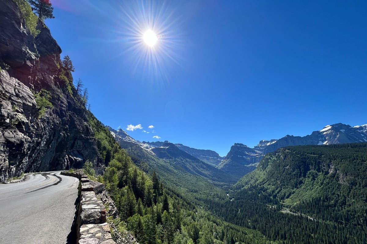
Going-to-the-Sun Road, Montana
Located in Glacier National Park, the 50-mile Going-to-the-Sun Road takes approximately two hours to drive. However, we recommend planning at least a half day, if not a full day, in order to take advantage of some of the overlooks and trailheads along the way. The Going-to-the-Sun Road winds past turquoise lakes, stunning waterfalls, dramatic cliffs, and alpine meadows, featuring the types of views that you won’t find on just any road trip. Note that oversized RVs are restricted on sections of this road—no vehicle longer than 21 feet or wider than eight feet will be permitted. There are services and lodging available at both ends of the road, but there are no gas stations along the route. The National Park Service offers a free shuttle, while Glacier National Park Lodges and Sun Tours offer guided tours of the Going-to-the-Sun Road. New for 2026, vehicle reservations are required to access the Going-to-the-Sun Road between May and September.
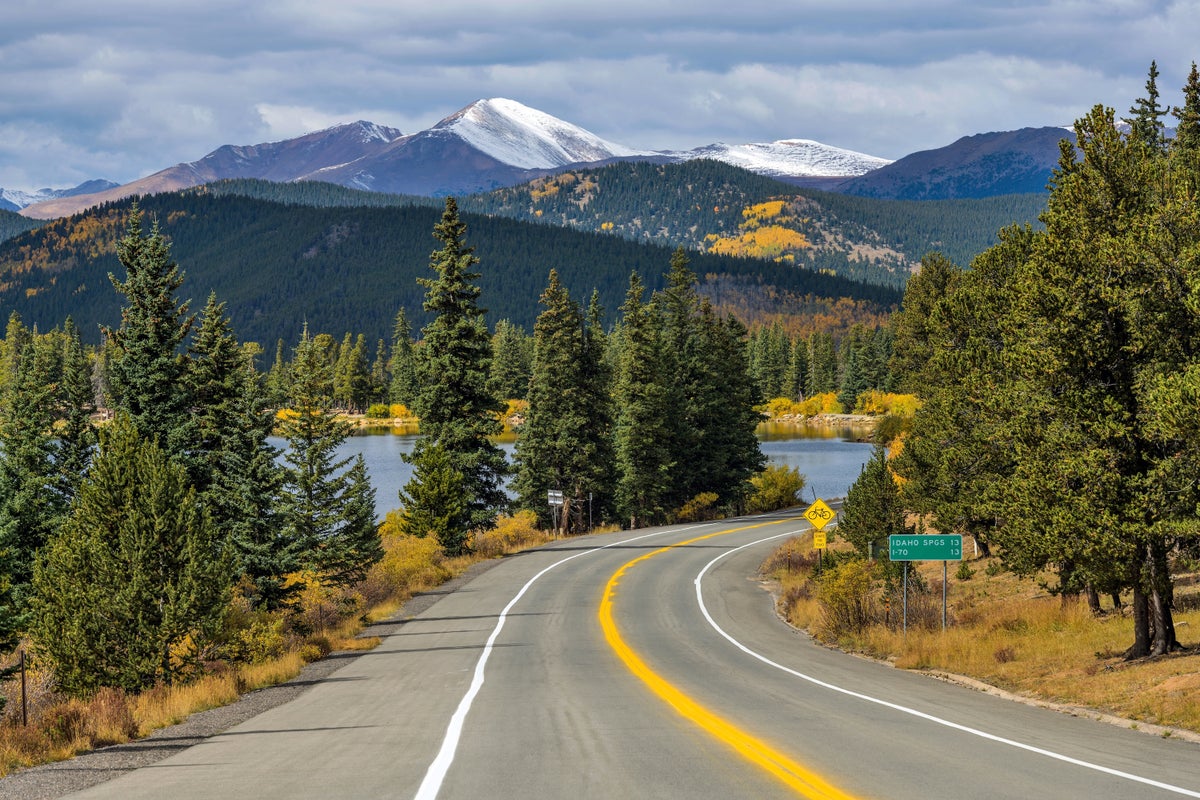
Mount Blue Sky Scenic Byway, Colorado
Approximately 60 miles west of Denver, the Mount Blue Sky Scenic Byway gains more than 7,000 feet over 28 miles, reaching the summit of Mount Blue Sky (formerly Mount Evans), one of Colorado’s famous 14ers. This route is the highest paved road in North America, featuring scenic views of the Continental Divide. You may even see herds of sheep or mountain goats amidst the rolling hills or wildflower-filled meadows. The Mount Blue Sky Scenic Byway drive takes about two hours to complete, but plan extra time for stopping to take photos or to enjoy a short walk at one of the high-elevation visitor areas. This road is steep and narrow, so smaller vehicles are recommended. To access the higher portion of the road, reservations are required from late spring through early fall. Lodging and other services are available in Evergreen and Idaho Springs.
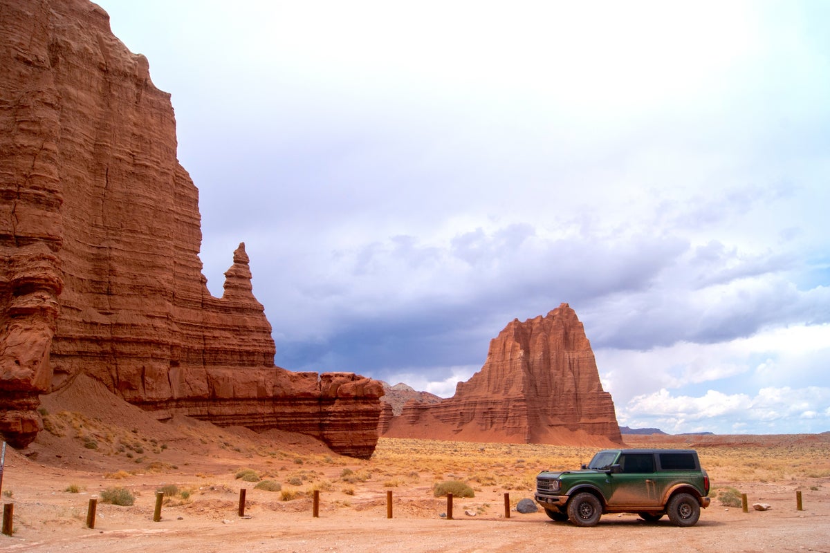
Cathedral Valley Loop, Utah
The Cathedral Valley Loop is not your everyday road trip. Located in Capitol Reef, the 57.9-mile Cathedral Valley Loop passes through the remote Cathedrals District, where you can see towering sandstone formations, unique natural phenomena, and sprawling desert scenery. The road is quite bumpy and often washboarded, and you will need to cross the Fremont River, so a high-clearance, four-wheel drive vehicle is required. Air down your tires by 15-20 PSI to improve traction (but remember to air them back up once you hit pavement again). While the Cathedral Valley Loop can be completed in one day, splitting the trek over two days and camping at the primitive Cathedral Valley Campground rounds out the experience. Pack plenty of food and water. If the site fills up, dispersed camping is also allowed on Bureau of Land Management portions of the road. Note that there are no services along this route and cell service is unavailable. Take a satellite phone along in case of an emergency.
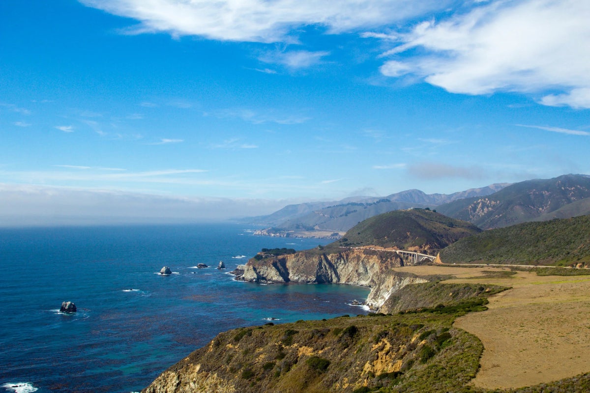
Pacific Coast Highway, California
The most beautiful section of the world-renowned Pacific Coast Highway 1 stretches roughly 90 miles between San Simeon and Carmel‑by‑the‑Sea. After more than three years of closures because of landslides, the entire route reopened early in 2026. Can’t-miss points of interest include dramatic overlooks where the Santa Lucia Mountains meet the Pacific, Pfeiffer Beach, McWay Falls, Bixby Bridge, the coastal trails and redwood groves of Pfeiffer Big Sur State Park, the majestic Hearst Castle in San Simeon, and much more. Although this stretch of the Pacific Coast Highway can be completely driven in a few hours, many travelers devote an entire day, if not more, and often spend at least one night along the route. While services are limited, there are plenty of great stops for a meal and overnight accommodations, such as Nepenthe and Big Sur Lodge. Be aware that hotels often get booked well ahead of time, especially over summer weekends. If you have trouble finding accommodations, consider spending the night in Cambria, to the south, or Monterey to the north.
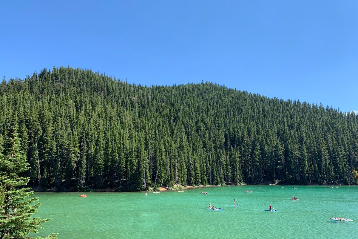
Cascade Lakes Scenic Byway, Oregon
The 66-mile Cascade Lakes Scenic Byway stretches through the Deschutes National Forest, offering a magical day trip from Bend. Highlights include views of the rugged, often snow-capped peaks of Mt. Bachelor, South Sister, and Broken Top, while trailheads offer hikes through lava fields and alongside the route’s stunning lakes. Although the drive can be completed in a couple of hours, many visitors set aside at least half the day for hiking or paddling adventures. Devils Lake, pictured below, is one of many stunning lakes along the route. Services are limited once you leave Bend, so fuel up and stock up on supplies in Bend before heading out. Snow lingers at higher elevations, therefore the byway is typically open from late spring through early fall.
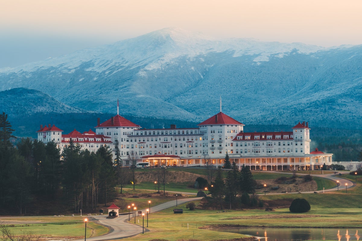
White Mountain Trail, New Hampshire
Looping approximately 100 miles through the heart of New Hampshire’s rugged White Mountain National Forest, the White Mountain Trail connects Lincoln and Conway with views of towering peaks, lush forests, and meandering mountain rivers. While it can be driven in a few hours, we recommend planning a full-day or weekend adventure to experience some of the short hikes, waterfalls, and mountain towns along the way. Explore the hikes and sheer granite walls of Franconia Notch State Park, ride the historic Mount Washington Cog Railway, and enjoy the mountain resorts along the way, like Cranmore or Attitash. To truly anchor the trip, consider making it a weekend affair with a stay at the Omni Mount Washington Resort, pictured below
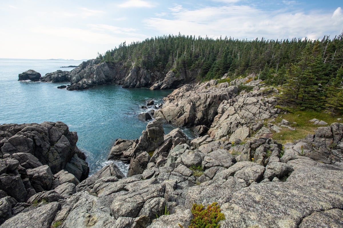
Bold Coast Scenic Byway, Maine
The Bold Coast Scenic Byway stretches 147 miles through Downeast Maine, leading travelers between Milbridge and Eastport along rugged shorelines, past quiet fishing villages, and through dense spruce‑fir forests. Highlights include bustling harbors dotted with lobster boats, sweeping views of the Atlantic, and access to wild coastal preserves such as Cutler Coast Public Lands, where dramatic cliffs and secluded coves reward short hikes. Make at least an entire day of it to take full advantage of the adventures to be had, which include exploring lighthouses and small towns rich with maritime history. Services are relatively limited between many of the communities, so fueling up in Milbridge, Machias, or Eastport is recommended.
Cherohala Skyway, Tennessee
Tennessee’s Cherohala Skyway stretches about 43 miles between Tellico Plains and Robbinsville, North Carolina, climbing through the Cherokee and Nantahala national forests and offering sweeping views of the Southern Appalachians. Highlights include high‑elevation overlooks, access to hiking trails and waterfalls, and long, quiet stretches of pristine mountain wilderness. Although you can drive the Skyway in as little as two hours, we recommend setting aside at least half of a day to enjoy the scenic overlooks, picnic spots, and short walks along the way. Services are limited once you leave Tellico Plains or Robbinsville, so fueling up beforehand is a good idea.